


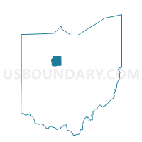
CAREY VILLAGE B Voting District, Wyandot County, Ohio
About
Outline

Summary
| Unique Area Identifier | 653447 |
| Name | CAREY VILLAGE B Voting District |
| County | Wyandot County |
| State | Ohio |
| Area (square miles) | 0.93 |
| Land Area (square miles) | 0.92 |
| Water Area (square miles) | 0.01 |
| % of Land Area | 99.25 |
| % of Water Area | 0.75 |
| Latitude of the Internal Point | 40.94696190 |
| Longtitude of the Internal Point | -83.39284440 |
Maps


Graphs
Select a template below for downloading or customizing gragh for CAREY VILLAGE B Voting District, Wyandot County, Ohio


Neighbors
Neighoring Voting District (by Name) Neighboring Voting District on the Map
- CAREY VILLAGE A Voting District, Wyandot County, OH
- CAREY VILLAGE C Voting District, Wyandot County, OH
- CRAWFORD TWP Voting District, Wyandot County, OH